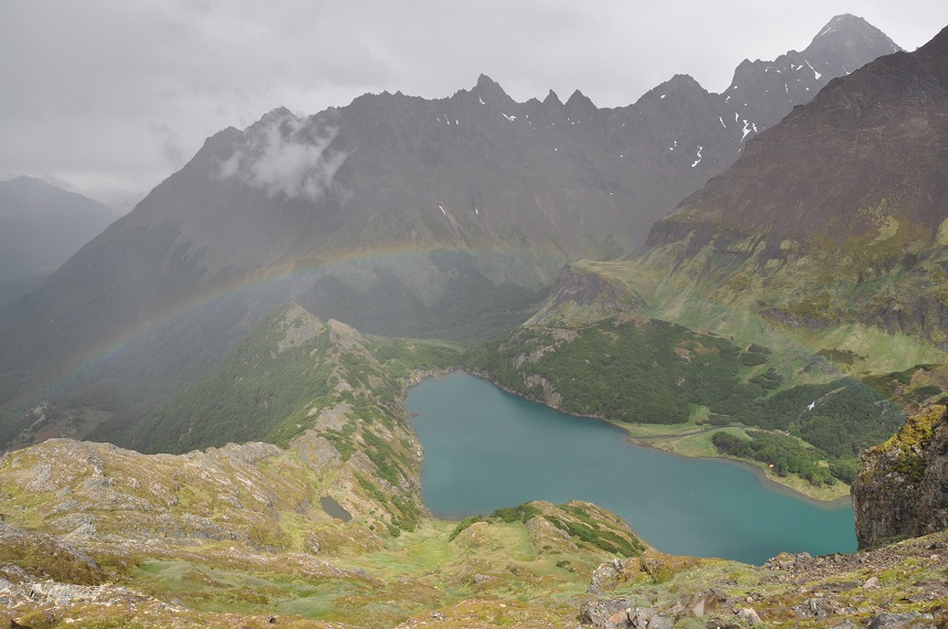
On January 3rd we set off from Ushuaia for what turned out to be, not surprisingly, a trip of a lifetime on the MS Expedition to Antarctica, returning on January 12th. Antactica can only be described as incredible. Mountains covered in thick layers of ice that spill down in inumerable glaciers to the water´s edge dominate the landscape. It is a place of little colour other than white snow, black rock, green water and blue ice. It is one of the, if not the most, beautiful places on earth. Not only is the scenery incredible but the ocean wildlife was everywhere. While there we saw elephant, weddel, crabeater and leopard seals, minke, humpback and orca whales and thousands upon thousands of penguins. We visited what is known as the Antarctic Peninsula, the arm that stretches north towards Tierra del Fuego. Only about 2% of the coast has areas where it is possible to land and the majority of those are found on the peninsula.
Before describing the trip the boat and crew need some describing. The MS Expedition is a Canadian owned, Liberian registered, Bahamian financed, Danish built former car ferry, (built in 1979) that spends half the year in the Antarctic and then heads north to the Norwegian Arctic for similar tours. We were two of 120 guests, including lots of Australians and Americans and not many Europeans. We had the lowest class cabin but were pleasantly surprised at how comfortable we were, even having our own shower. Compared to the bunk beds we´d been used to in Argentina this was posh! We were also strategically placed right next to the ´mud room´ where we were to dress for each outing once in Antarctica. The main thing we did on the boat was eat, and then eat, and then eat some more. Delicious meals were served by an entirely Filipino hotel staff (minus the Brazilian manager) in a dining room big enough for all guests to sit. Breakfast was at 7:30 (buffet), lunch usually around noon (buffet), tea (four-ish) consisting of sandwiches or cakes and then supper at around 7:30 (sit down). To say the meals were fantastic would be an understatement. The Filipino themed dinner was one of the most delicious meals I´ve ever eaten! To top it off there were two bars and thanks to an group of Australian air force pilots they were guaranteed to be hopping until two or three in the morning.
The crew were a mixed bunch as well. The ship´s captain was Bulgarian, with a mix of Ukrainian, Polish and Filipinos reporting to him. The Expedition staff (those who guided us around on landings and in zodiacs) were led by a Chilean, with Canadians, Americans, Brits, an Argentine and a Kiwi doctor reporting to him. These people included boat drivers, biologists, geologists, environmentalists and even a fellow from Sudbury providing the nightly entertainment. Whenever we had a question it wasn´t hard to find an answer. The best staff member was an American biologist named John who talked like Captain Kirk and would say things like ¨people often ask me, they say ´John, can we feed the Orcas?´and I say ´no, you can´t feed the Orcas´¨. He was actually pretty ridiculous. His dance moves were even better. He provided all the entertainment I needed for the entire trip.
 |
| The MS Expedition |
The rythm on the boat once we reached Antarctica was to have breakfast, then head out on an excursion via a 13ft zodiac (all named after Canadian provinces or territories - we got to ride the NWT once!) with a 50hp to either to the shore or in and around ice, then come back for lunch and do a similar excursion before dinner. All of this was weather dependent but we were fortunate to not miss one landing or zodiac opportunity. In total we left the boat nine times, setting foot on land seven times and cruising in zodiacs twice. A previous cruise only got off the boat twice the entire time.
 |
| Our favourite zodiac |
Our itinerary was as follows:
January 3-5 - crossed the Drake passage, which despite being considered the worst body of water in the world for weather and waves turned out to be fairly benign. On the way out of the Beagle Channel we saw two Minke Whales surfacing for a bit, fairly close to the boat. We were so fast crossing that we had an entire afternoon at Aitcho Island in the South Shetland Island group on the 5th, which is rare. This is where we first saw Antarctica as well as lots of Penguis, a Weddel seal and lots of, what John called, ´Blubber Slugs´ - Elephant Seals.
 |
| South Shetland Islands - our first view of Antarctica |
 |
| Ice fields in the distance of Aitcho Island |
 |
| ´Blubber Slugs´ (Elephant Seals) on Aitcho Island |
 |
| A huge ice berg off of Aitcho Island. An ice berg is defined as a piece of ice larger than a ´typical english thatched cottage´. |
 |
| Mike pretty close to a Chinstrap Penguin on Aitcho Island. |
January 6 - during the night we crossed the Gerlache Strait to anchor off of Cuverville Island by morning, where we hiked up for some pretty fantastic views. Later that afternoon we visited Port Lockroy where a 1944 British base still has some buildings that are being maintained by a British foundation. The Pt. Lockroy Base, part of a string of seven bases, was built to monitor potential German movements during the second world war. It turned out to be of no use but was then converted into a scientific base until the 1970s (or so). It still has a functioning Post Office and the site is home to thousands of Gentoo Penguins. There were three sailboats anchored here waiting for ice to improve further south. When we were in the zodiac on the way back to the big boat we watched as a leopard seal destroyed a penguin - something not seen all that often from so close.
 |
| On the way to Cuverville Island. |
 |
| The view from the side of Cuverville Island. We slid down the snow to get down and Mike´s pants almost came off. Another guy busted his face off the snow. Good times. |
 |
| Massive ice at Port Lockroy |
 |
| A permanent resident at Port Lockroy - a Gentoo Penguin |
 |
| The blue is caused by a lack of air due to compression - this ice might be 10,000 years old. New ice and snow is white because it is filled with air. The ice was Mike´s favourite part of Antarctica. |
January 7 - Early in the morning we set sail for the narrow Lemaire Channel which is often so choked with ice that it is often impossible to pass. It was incredible how the boat smashed 50ft pieces of ice into little shards as we worked our way down the channel. We eventually stopped in a bay filled with ice bergs where we were toured around on zodiacs (John was our driver, awesome!). We saw a leopard seal up really close and even got to stand on some sea ice for some pictures. It was here that made our furthest south at 65´05´´ S. In Inuvik we are at 68´30´´N so we were about 15,000km from home! That afternoon we cruised back north in our first real sun and warmth to Neko Harbour where once again we climbed for great views and some sliding (which we didn´t do, snow wasn´t good for it). On the way a group of about 30 Orca whales swam past, obviously on a mission to get somewhere - unfortunately we didn't have a camera on us. Once at Neko Harbour we waited patiently for pieces of ice to bust off the glacier but none did. Neko Harbour was the only place we actually touched the continent proper.
 |
| Two crabeater seals lounging in the Lemaire Channel |
 |
| Our path through the ice in the Lemaire Channel |
 |
| Mike waiting for the call to board the zodiacs. Already dressed! |
 |
| A Leopard Seal up close. This was a big one, so says John, at about 10ft long. |
 |
| A crabeater seal - the most numerous seal in the world and all live in Antarctica. |
 |
| The icebergs in the Lemaire Channel were amazing; all sorts of shapes... |
 |
| ...with beautiful colours... |
 |
| ...and strong enough to stand on. |
 |
| On the way to Neko Harbour. The ice on the mountain tops was common. |
 |
| A couple of crabeater seals lounging in front of this volcanoe lookalike, due to clouds, in Neko Harbour. |
 |
| It was almost hard to take a bad picture here. |
 |
| A humpback whale diving just before we had dinner. |
 |
| The ship surrounded by ice. Often the bergs would bump into the boat. When we asked the Polish second in command about this he shrugged and in a fantastic accent said ¨shit happens¨. |
January 8 - In the morning we sailed a short distance to what is called Paradise Bay where a Chilean and Argentine base are located. We took a tour of the face of a glacier, hoping to see a piece of ice fall in (we saw a little one). From there we motored south to Daco Island where we again hiked up the snow for some great views and heat! After our visit there we began the night crossing of the Gerlache Strait again, this time heading for Deception Island. The evening of January 8 was gorgeous, super warm and clear. The bar was pretty full and Elise and I both partook. We saw a couple of humpback whales both breach at the same time off in the distance. The beauty of the scene prompted John to clench his fist and yell 'YES!'. A note about the bases. Antarctica is not owned by any country, though seven nations (Britain, Norway, Chile, Argentina, Australia, New Zealand and S. Africa) have made claims. The current governance of the continent is through a UN treaty that neither recognizes or dismisses these territorial claims - it merely ignores them. It was entered into in the early 1960s and still functions today. The treaty is based on conditions requiring the peaceful use of the continent for scientific purposes only and complete transparency. To be a decision maker with respect to the treaty a country must establish and support a year round base on the continent. To date some 21 (?) nations have done this, including the United States and Russia. However the treaty is periodically reviewed with the next review scheduled for 2041(?) and it is always feared that either mining extraction will be allowed or the treaty will be abandoned. The original claimant nations are very keen to maintain bases, even if just to wave a flag in case the treaty fails. Since Chile and Argentina have overlapping claims you will typically see a Chilean base near an Argentine one.
 |
| The view from our window the morning of January 8 |
 |
| The Admiralty Brown Argentine base at Paradise Bay. Don't let the fresh paint fool you - the base will not be used this year other than as a symbol. |
 |
| More cool ice. |
 |
| More cool glaciers. |
 |
| Same. |
 |
| Same, but near Daco Island. |
 |
| The view from the top of Daco Island. |
 |
| Just chillin' in Antarctica, you know. |
 |
| Zodiac right up close to some crabeater seals at Daco Island. |
 |
| The ride across the Gerlache Strait. |
 |
| Same. |
 |
| Same. |
 |
| Roger (Netherlands), Mike and Mike (Australian) drinking scotch with 50,000 year old ice. |
 |
| In this scene we saw two whales breach side by side, just to the left. |
January 9 - With sore heads we woke up and found ourselves near Deception Island. I didn't (couldn't ?) get breakfast and Elise dragged me into the mud room and we got in the zodiac and headed in. Deception Island is a collapsed volcanoe that has formed a perfect harbour. It was home to a very large whaling station, run by Norwegians, until the 1920s, then was a scientific station for the British until the 1960s. At some point both the British and Chilean bases on the island were smoked out due to a massive mud slide caused by volcanic activity. While we were there the weather turned, with rain and sleet blowing horizontally. While others were cowering, we kind of loved it, both commenting on how it reminded us of home. The island was pretty neat but didn't really remind us of typical 'Antarctica' because its volcanic origins make it hotter so no snow sticks around. After Deception Island we cruised over to Half Moon Island and spent our last hours in Antarctica before heading to Ushuaia again. The island had lots of penguins, including our first Macaroni Penguin (with the yellow hair on top).
 |
| Deception Island. |
 |
| These massive drums were used to hold whale oil. Some seals and whales were once hunted almost to extinction in Antarctica. Seals are making an impressive comeback, while the whale populations are slowly recovering. |
 |
| The old whaling station turned research station that was mud-flooded out. |
 |
| Half Moon Island penguins. Mainly Gentoos and Chinstraps with... |
 |
| ...one Macaroni penguin, the only one we saw the entire trip. |
January 10 - 12 - We recrossed the Drake and this time we had an indication of the weather with 80km winds and 4m waves. At points our porthole was completely under water. We pulled into Ushuaia on the morning of the 12th, made our way up to Antarctica Hostel one more time and contemplated what we had just experienced. Truthfully we were both a little bumbed out thinking we wouldn't be able to enjoy the rest of our trip after having seen such an amazing place - we're both incredibly lucky and glad to have done it, regardless of the cost.
 |
| Hola from Antarctica. |